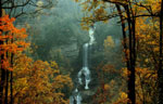
Wildcat Branch Falls
| Physical
Address
(no physical address
see below for directions)
Web |
More
photos |
Photo Suggestions
 |
Best to shoot the falls when there is a lot of water
crossing the falls
|
|
|
Two falls, one on the road and the second about 50
yards above the one on the road.
|
|
|
The second falls (middle falls) is more impressive
|
|
|
Once across the creek, the trail
heads up hill a short distance to an information kiosk with a trail
map of the area. Just past this is what's left of the old picnic
shelter - the chimney and foundation.
|
|
|
From the chimney, continue up the
trail for a very short distance to the beginning of the loop. Taking
the left trail, cross the small creek on the rocks and continue to
the upper waterfall which is about 1/2 mile from the parking area
|
|
|
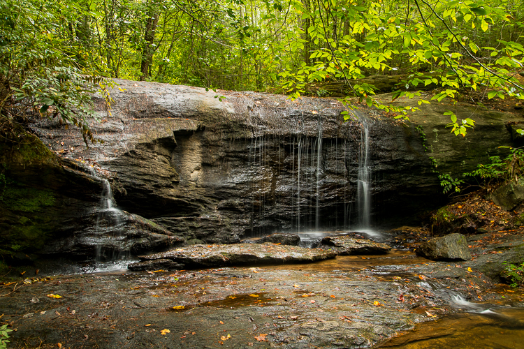
Here you will see signs warning
you of the dangers of climbing the rocks beyond where the trail
goes. At the very bottom of the drop is a jumble of boulders, but
the trail will take you up to a flat part where you can safely view
the water sliding down the huge rock wall
|
|
|
This waterfall is listed at 100'
high, but that might include the boulder part also. Either way, it's
worth the hike if the water is flowing and would be really
impressive in high flow. During periods of dry weather, this creek
can be only a trickle. |
Driving Tips and Other Information
 |
The falls are in the six mile
section of Hwy 11 and 276. It is about 5 miles from where the
two highways join.
|
|
|
It is a non-descript pull off on the right side of
the road coming from Greenville. At the full off, there is a
sign "Wildcat Wayside". It is part of the SC State Park
system.
|
|
|
If you miss the pull off and get to where Hwy 11 and
Hwy 276 separate, then back track about 1/2 mile.
|
|
|
After shooting the falls, follow the trail a short
distance to the foundation of an old building. It could make
for a good HDR shot. |
Information compiled by Bob Spalding
|