|
||
|
| Physical
Address 4232 SC Hwy 11 / Cherokee Foothills Scenic Hwy Marietta, SC 29661 |
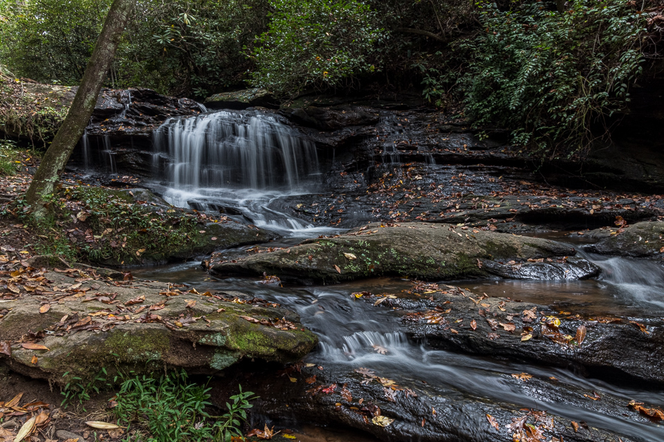
Photo Suggestions
|
|
Best time to photograph the falls
is in morning. |
|
|
There are plenty of points that
you can photograph the falls from. You can step on some stable
rocks and photography it while in the creek, or you can photograph
it from the side. |
|
|
There is a bench at the top of
the falls on the trail that offers a good framing photograph when
the leaves are present. |
|
|
There is also a unique rock wall that can be photographed, however, you can not see the falls from this position. |
Driving Tips and Other Information
|
|
The falls are located in
Greenville County Pleasant Ridge County Park about 5 miles from
Jones Gap and Caesar's Head state parks. |
|
|
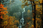
This is a small double tiered
falls. The first section drops about 8 feet down a tiered
cascade, then flows another 25 feet before coming to the second
tier. Then it drops off about 15 feet. |
|
|
Once you turn into the park (SC
Hwy 187), take the first left to Shelter Number 1 and park
Cross a small bridge and stay to the left.
Go to the end of the grassy area. There you will see a sign
Leroy Smith Nature Trail. Follow the trail for approximately
.02 miles and you will come to the falls. |
|
|
Bathroom facilities available near the parking area. |
Information compiled by Bob Spalding